Redistricting Process
The information below is regarding redistricting of trustee areas.
What is Redistricting?
Every 10 years after the United States Census is conducted, local public agencies that elect their officers by or from geographical areas, districts, divisions or wards must “redistrict”. This requires them to review the population data from the most recent Census and, if necessary, adjust the boundaries of those areas, districts, divisions or wards to keep them as nearly equal in population as possible, allowing for certain variances due to geography, topography, keeping communities of interest together, etc., as set forth in Federal and State law.
In some cases, the population data for an agency may have changed little since the last Census. In this case, the map may remain “population balanced” as required by law, and no map update is necessary. On the other hand, where the local population has grown or shifted significantly, an updated map will be necessary. In either event, the agency must analyze the most recent Census data to determine if a map update is necessary.
This process of evaluating and adjusting boundaries is referred to as “redistricting.”
What criteria are used to create trustee areas?

Federal and state laws require that the trustee areas be nearly equal in population using the most recent Census counts.
Federal law also requires that election districts be drawn to respect protected race/ethnic groups so that their communities are neither divided nor overly concentrated in individual districts.
For County Boards of Education, California Education Code Section 1002 reads as follows:
“The trustee areas shall be as nearly equal in population as may be, except that in establishing or changing the boundaries of the trustee areas the county committee may give consideration to the following factors:
(1) Topography.
(2) Geography.
(3) Cohesiveness, contiguity, integrity, and compactness of territory.
(4) Community of interests of the trustee areas.
In any event, the county committee shall ensure that trustee areas are as nearly equal in population as practicable.”
Additionally, County Boards are required to “fix the boundaries of trustee areas, insofar as possible, to coincide with the boundaries of school districts.” Education Code § 1002
For Imperial County, all references to the “county committee” have been transferred to the Board of Education which serves in this role.
Who creates the maps and how can the public participate in the process?
Redistricting is based on feedback received from the County Board of Education trustees and from the community during the scheduled meetings.
Members of the public were able to provide input about boundaries, as well as possible revisions of plans. The redistricting process is transparent and open to public input.
The following regular Board of Education meetings were utilized for public hearings throughout the process:
- Monday, November 8
- Monday, December 13
- Monday, January 10
Board Meetings start at 5:30 p.m. and are held in ICOE's Boardroom located at 1398 Sperber Road, building C.
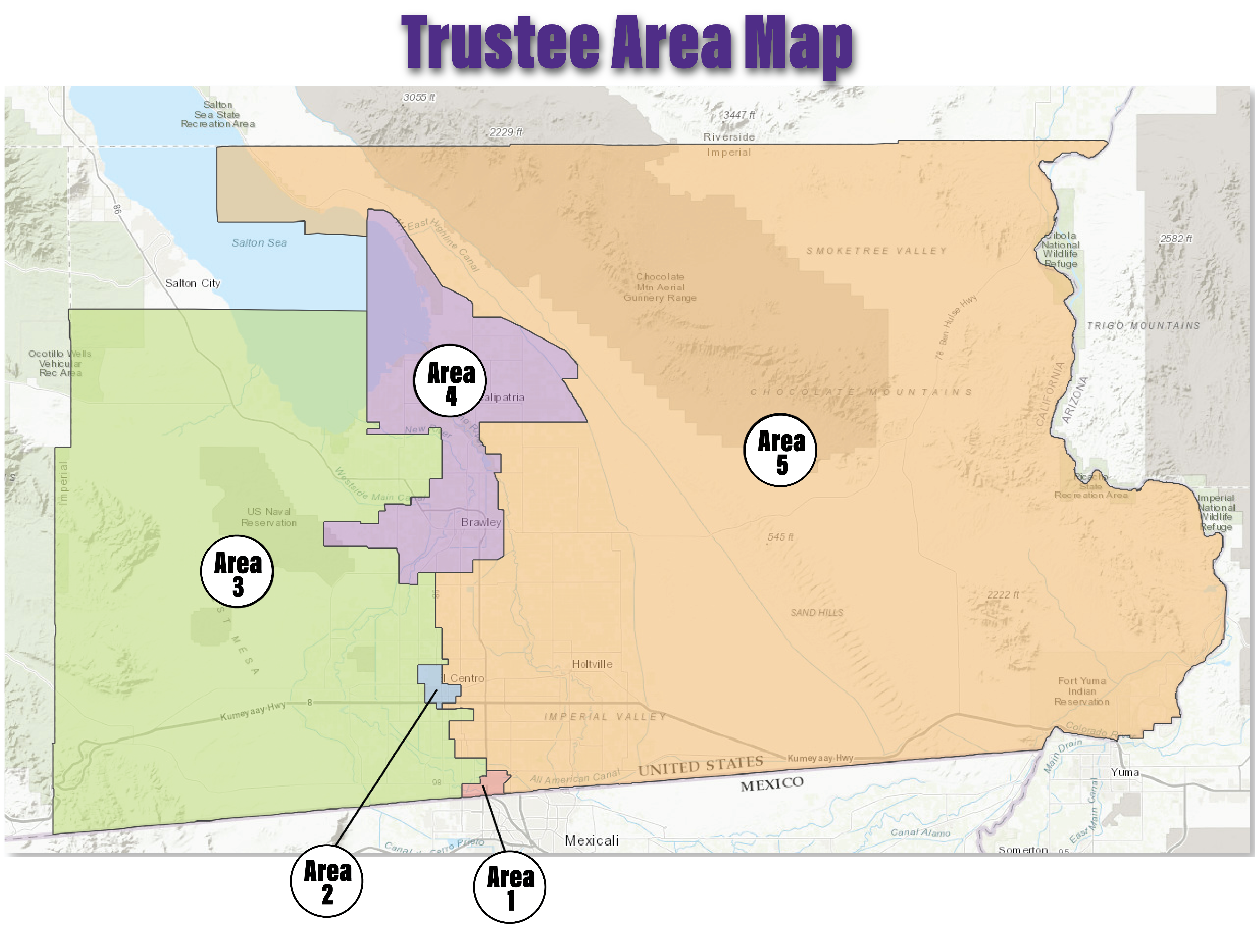
See map for additional information.
The Board of Education has contracted with Best Best and Krieger, LLP to facilitate the process and to evaluate and adjust trustee area maps as may be required. The January 10 meeting was used to adopt the final maps of trustee area boundaries for the Board of Education.

When will the new trustee area maps be used?
The new trustee areas will be in effect for the November 2022 elections.
Who decides which map to adopt?
The Board of Education will adopt an ordinance establishing election district boundaries by February 28, 2022. The county Registrars of Voters will then adjust precinct boundaries before the filing deadline for the November 2022 trustee election.
How long will the boundaries be in place?
By law, election district boundaries must be evaluated after each decennial census. The next review and adjustment to area boundaries will occur in 2031 using the 2030 U.S. Census data.